New no-dig seismic technology helps farmers understand compaction in extreme climates
 Agri-TechE
After a record-breaking dry summer made conventional soil compaction testing nearly impossible, Harper Adams University and Agri-TechE Ambassador Todd Jex utilised seismology equipment to assess whether this non-invasive technology could provide the intel needed to help farmers prepare for future climate extremes.
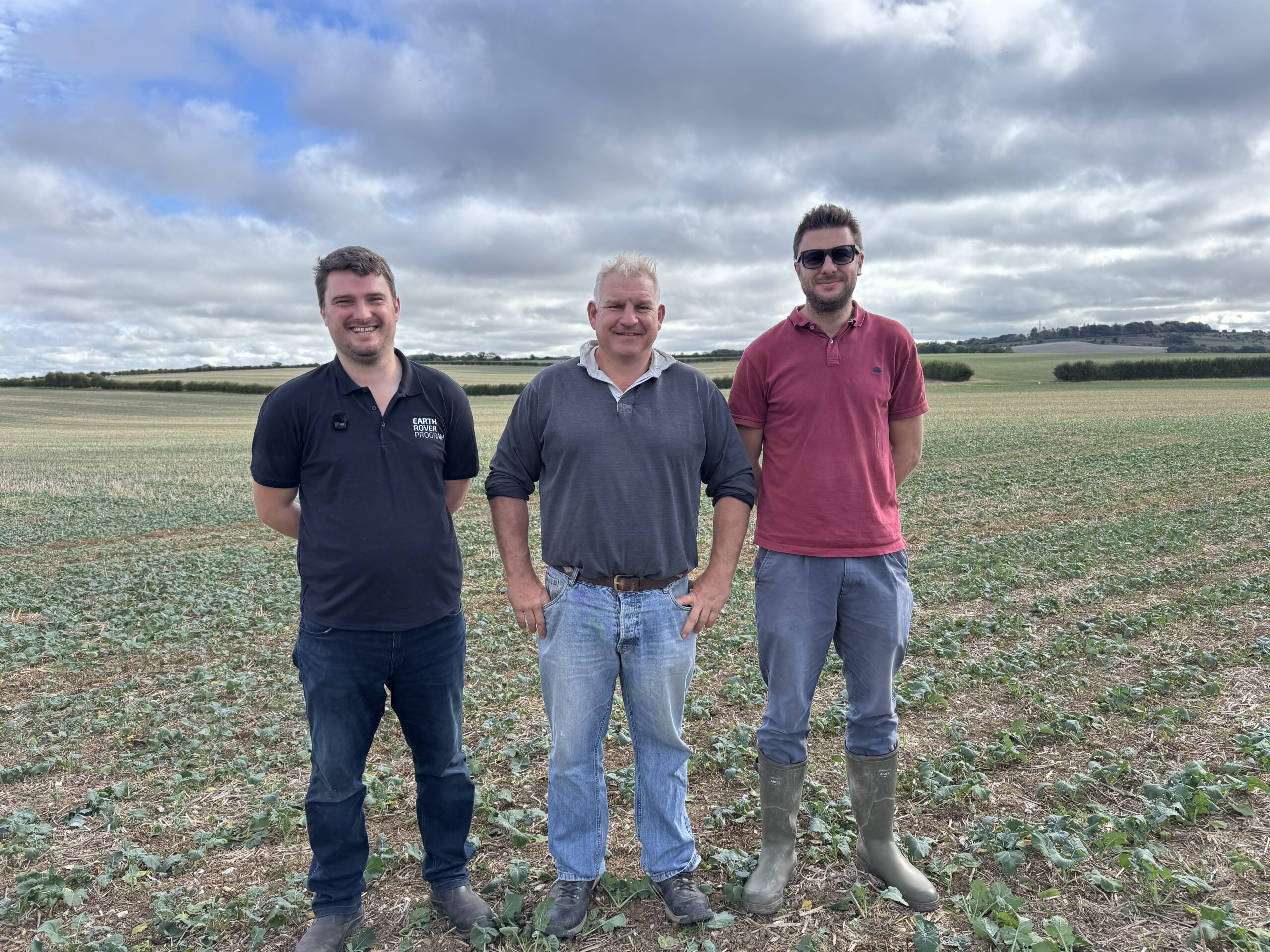
Agri-TechE Ambassador Todd Jex partnered with Agri-TechE member Harper Adams University ahead of the annual REAP conference on 4th November to learn how seismology, traditionally used in geological surveys, can identify soil compaction without needing to dig.
David Lemon, a Dorset farmer supported by Todd as his agronomist, manages six farms with around 3,000 acres for cultivation, each on its own crop rotation, plus additional land for combining and spraying.
The test farm follows a crop rotation of wheat, spring barley, winter barley, and oilseed rape, with occasional maize and alternative crops, across a mix of soil types, including clay, chalk, and green sand.
Compaction Challenges
David predominantly farms using conventional methods, traditionally using a Simba SL 400 cultivator pulled by a tractor, which causes compaction problems and has also led to blackgrass challenges.
“We do suffer from mechanical compaction and, particularly with the cultivations, we would get slumping in the sand,” says David.
He has started exploring regenerative approaches, moving to a Weaving LD at 300 horsepower, direct drilling around 50% of crops, using companion and cover cropping, and integrating livestock.
“We’ve probably reduced 20,000 litres of diesel just from changing our cultivation strategy,” says David.
“It also means we don’t suffer quite as much from manganese deficiency on the green sands as we have traditionally done, because we’ve been constantly hollowing out seed beds”.
Todd has worked with David for more than a decade and has seen extreme climates affect the soil, finding cover crops a useful way to manage compaction across different soil types and crops.
“Historically, compaction has been a challenge to try and remedy some of the problems following a crop like maize and get the crop established nicely,” says Todd.
“Recently, our winters have been the opposite of our spring summers; it’s almost rained every day. The soils have been at field capacity for most of the winter, which is a challenge.
“In the absence of a shielding crop or cover crop, the ground has been exposed to a tremendous amount of weight from the rain coming down and compressing the soil. So that’s a huge issue and a huge problem on farm,” says Todd.
Historically, the team measures compaction using penetrometers, which Todd says has been challenging, especially in recent dry climates.
“We want to know what compaction we’ve got and where it is in the autumn before preparing the ground for crops. With the ground being so dry, it’s rendered the penetrometer pretty useless for the last two autumns, and by the time we’ve got enough moisture in the soil, the opportunity for testing is gone because the crops in the ground are growing,” says Todd.
Could seismology offer an alternative?
Joe Collins, Senior Research Associate at Harper Adams University and the Earth Rover program, is working on a seismic technology that uses the distance of sensors from a seismic source (e.g. stamping a foot on the ground or a hammer) to calculate the speed at which waves travel from A to B; this then identifies soil horizon depth for managing carbon stocks, low bulk density, areas of compaction, and soil moisture.
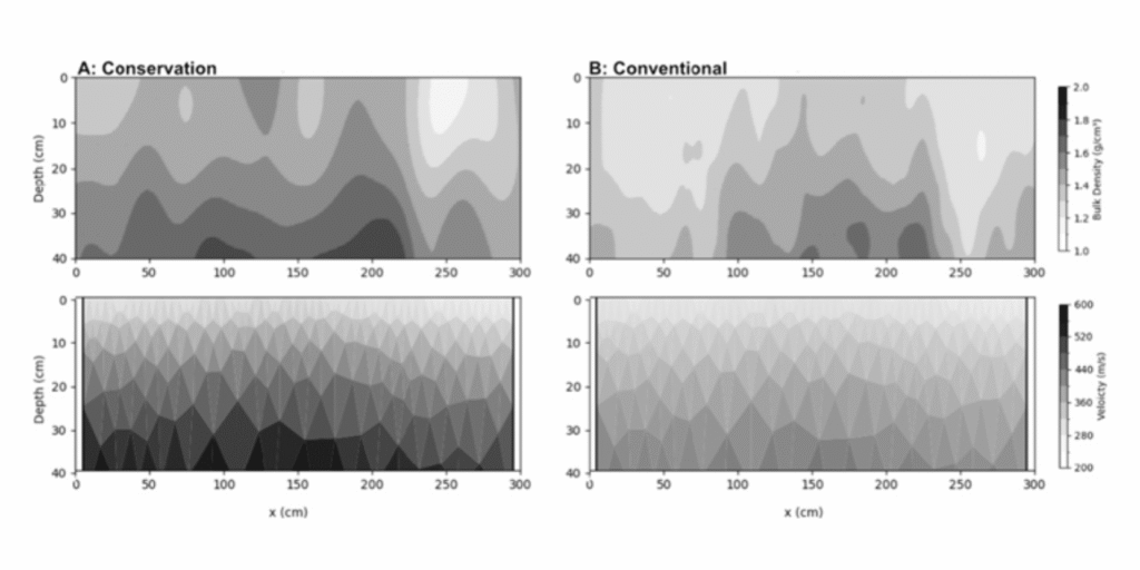
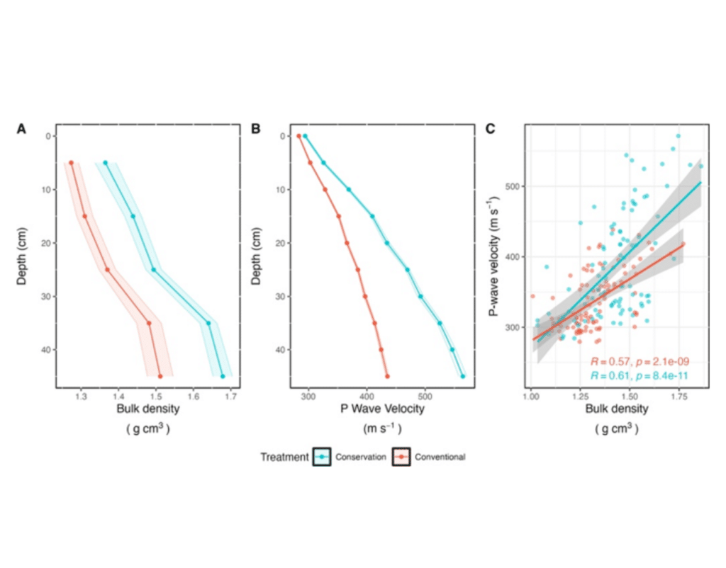
Research conducted last year on a farm in Shropshire used the technology to investigate the upper 40 cm of soil, comparing conservation agriculture with conventional cultivation (Tsekhmistrenko, et al., 2025)..
The study showed that seismic measurements could identify differences in soil conditions between the two farming systems, enabling researchers to produce cross-sectional images of the soil that showed how seismic wave velocity varied with depth and distance (see Figures 1-3).
Using seismology for a targeted approach
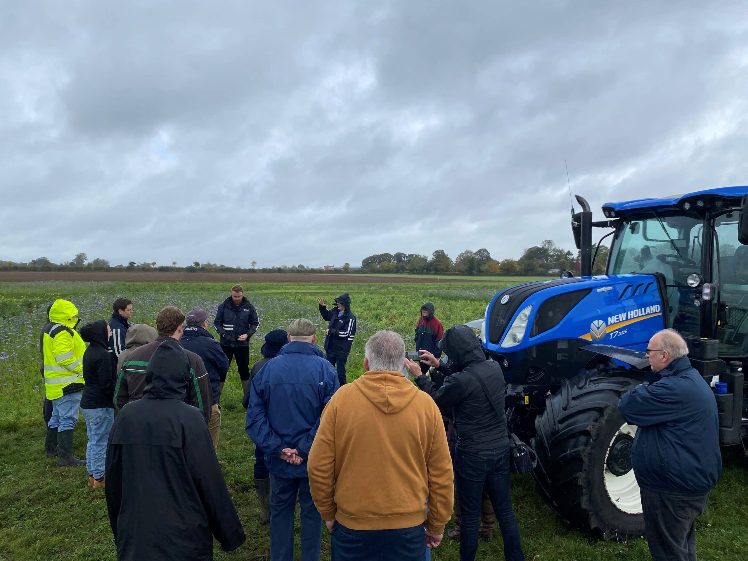
The trial between Todd and Harper Adams included a demonstration on David’s farm to assess whether seismology could identify compaction and to support further research.
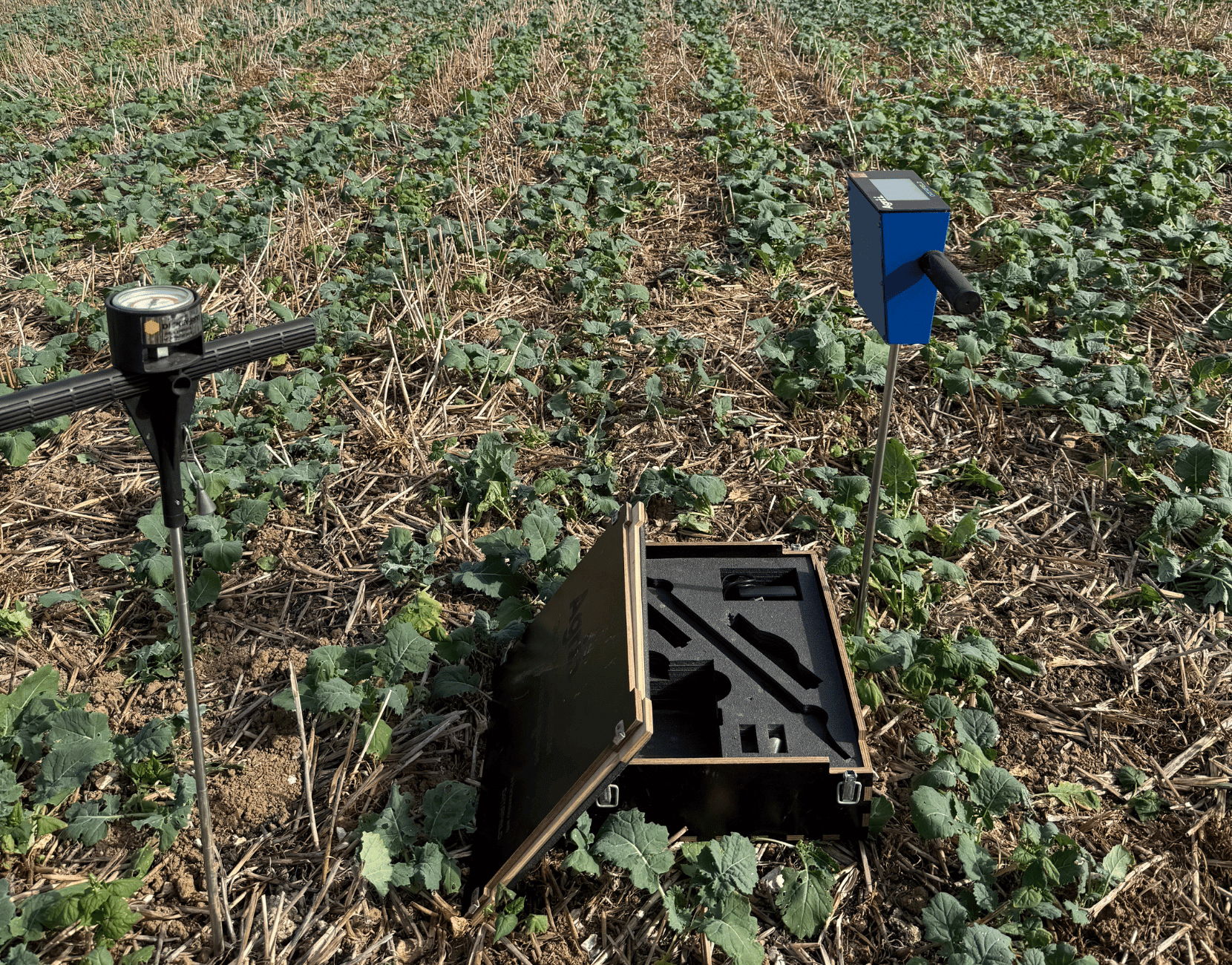
During the field demonstration, the team used a hammer to generate small seismic waves that travelled through the soil and were recorded by a series of sensitive sensors, known as geophones.
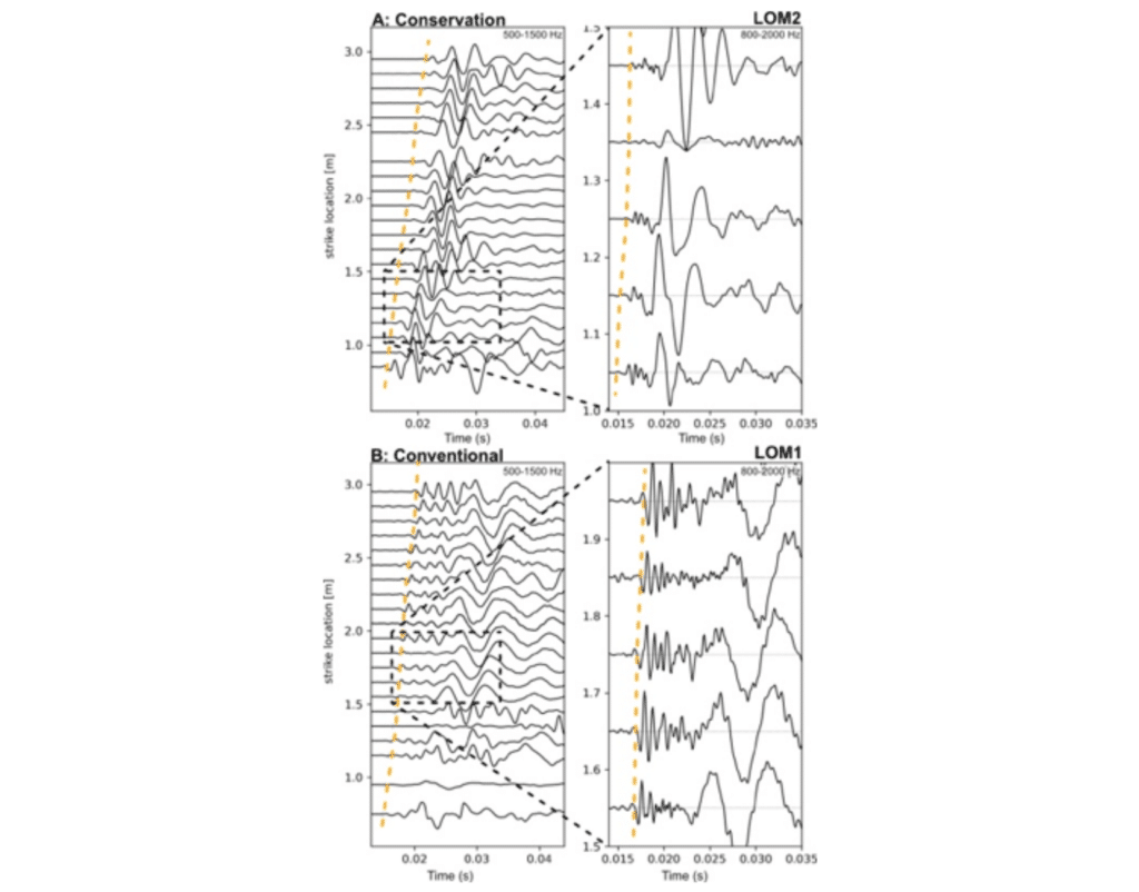
Early imagery (Figure 4) shows the recorded seismic signals, with each line representing the vibrations detected by individual sensors, and peaks and troughs showing how the ground responded to the hammer strike.
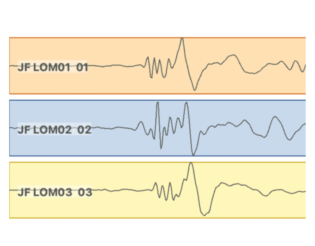
“Although these recordings have not yet undergone full analysis, they provide the raw data needed to investigate the physical properties of the soil beneath the surface,” says Joe.
“The next step is to measure how quickly the seismic waves travelled between the sensors. These measurements will then be used to build a picture of how seismic wave velocity varies with soil depth and location.”
He explains how this could benefit farmers, since compaction can cost individual farmers a lot of money. Instead, seismology could help target key areas of a field needing attention to reduce compaction.
“Instead of just a point measurement, sending it off to a lab, for example, we can create 3D images of soil non-invasively”.
Joe discusses how the kit could work in practice, using a prototype mobile phone app currently in development. The future could have three options: a farmer could place their phone on the ground and walk around while the app provides an image of the soil beneath their feet; use a tractor-mounted setup; or use a passive method with sensors set up between tram lines.
Todd explains how this technology could help farmers and agronomists address problems more precisely on the farm.
“We got quite excited about five years ago about carbon capture. Every time you put a tine in the ground, you’re releasing carbon. If you suddenly discover that you don’t have to put a tine in the ground on 20 % of your farm, then that’s 20 % less carbon emitted,” he says.
Research vs Reality
David questioned why this would be a better alternative to the market if you can’t act on the information because of weather or other factors.
However, Joe emphasised that seismology enables a more targeted approach and supports more efficient farm management by taking measurements over several years, rather than relying on a single standalone measurement. This makes it possible to monitor changes proactively rather than reactively, and to inform long-term decisions.
“Our hope is that your farm management system could save the data over the years and take into account things like annual rainfall, combined with 3D images so you can track how your soils are progressing over time,” says Joe.
The Agri-TechE ambassador programme aims to partner farmers and agronomists with researchers and innovators early to discuss challenges and solutions like this ahead of commercial release, so new technology is co-developed with farmer needs and approval.
“I think a potential pitfall in some of this technology is developing something where the science is fantastic and has so much possibility and then, from a practical sense, a farmer picks it up, and says, it’s just not going to work on farm,” says Todd.
“I think the REAP conference is a good opportunity for bringing people from different parts of the industry together to make sure that doesn’t happen, and the ambassador program is important for getting some of these early technologies onto farms and seeing them first-hand and discussing it with the eventual end users”.
Research into Practice at the REAP Conference
What is the impact of scientific research on agriculture, and how does it directly benefit farmers? Leading scientists from top UK research institutes tell us at REAP 2026.
Todd and Joe will both be at this year’s Agri-TechE REAP conference, on 4th November at Peterborough.
“The REAP conference is all about bringing new technology to the forefront and connecting farmers with innovators. Through the ambassador programme, it’s fantastic to see this kind of collaboration already happening ahead of the event,” says Dr Belinda Clarke, Director of Agri-TechE.
“If people want to find out more, see some of the technology in action, or speak with key stakeholders, researchers and farmers, we welcome them to join us in Peterborough for this year’s conference.”
For more information and to purchase tickets, visit Agri-TechE’s event booking.
Post Overview
Agri-TechE Related Posts
ATW 2025: A Tour of Agrii’s Flagship Throws Farm Technology Centre
Digital Data in UK Farming
ATW 2025: You have to start somewhere
Every Kilogram Counts – Why Soil Testing Is Now a Financial Decision
How national data sharing could boost farm incomes and ensure food security