Field boundaries based on real world data
There has been much dispute over field boundaries as they move over time. To address this and provide a consistent framework for further data analysis, Agrimetrics has used artificial intelligence to identify the UK’s field boundaries from satellite imagery supplied by Airbus.
Professor Richard Tiffin, Agrimetrics Chief Scientific Officer explains the importance of this: “Field Boundaries provide a detailed digital map of the UK’s farmed landscape, what’s less well known is that they also provide a framework for organising and assembling data and the foundations for building new products.”
The 2.8 million digitised field boundaries connect to more than a billion other data points – creating an unrivalled resource for stakeholders across the agri-food sector.
Data sets which could previously only be viewed by region or county can now be viewed from the perspective of an individual field. This has profound implications for a range of stakeholders. Software developers will be able to improve user experience, input manufacturers can increase the efficacy and sustainability of their products and researchers can undertake innovative and important research – producing practical insights which improve farm management.
Kathryn Berger, who leads the data science team responsible for bringing Field Boundaries to life: “To create field boundaries, we trained a machine-learning algorithm to look at satellite data, identify the land features which distinguish fields, and use these features to highlight the field boundaries.”
“Where Agrimetrics differs from other providers, however, is in the precision of the satellite data we use. Whereas industry-standard satellite imagery might have a spatial resolution of 10 to 20 metres, we used premium SPOT satellite imagery supplied by Airbus, which has a resolution of just 1.5 metres.”
“The increased precision of our source data gives our algorithm a distinct advantage when identifying field boundaries.”
More information about Agrimetrics.
Post Overview
Related Posts
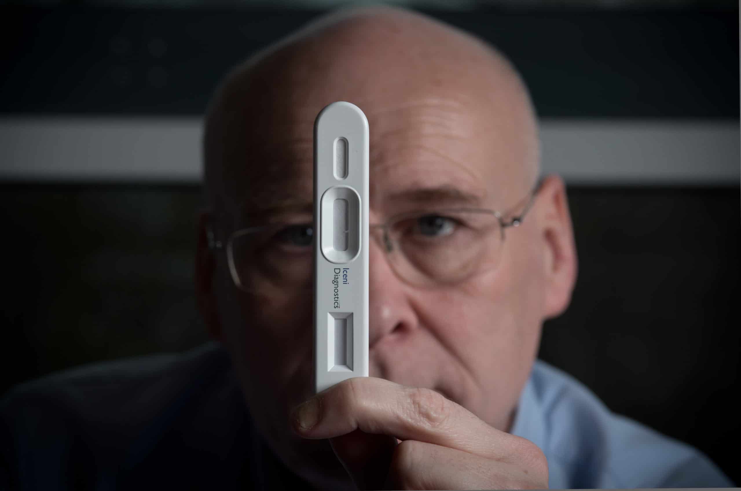
Iceni Diagnostics offers new approach to detection of COVID-19

ClearSky technique to overcome cloud cover issues
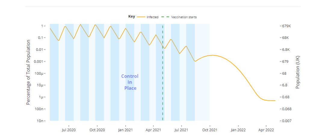
‘lowhighcovid’ tool highlights the potential impact of different disease control strategies

Golden age of Earth observation in agriculture says Airbus speaker at REAP 2021
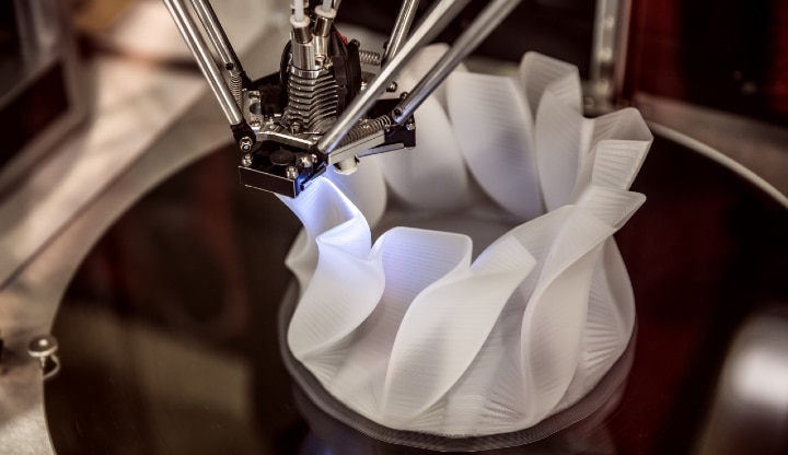
UEA launch project to 3D print ventilator parts and masks