Drone Ag Launches Skippy Scout’s Spheres Version 2
Drone Ag Launches Skippy Scout’s Spheres Version 2: A Major Upgrade to Its Advanced Field Visualisation Tool
Drone Ag is proud to unveil Scout Spheres Version 2, a major upgrade to its advanced field
visualisation tool within Skippy. This latest release introduces a redesigned user interface,
developed to deliver a cleaner and faster experience for users.
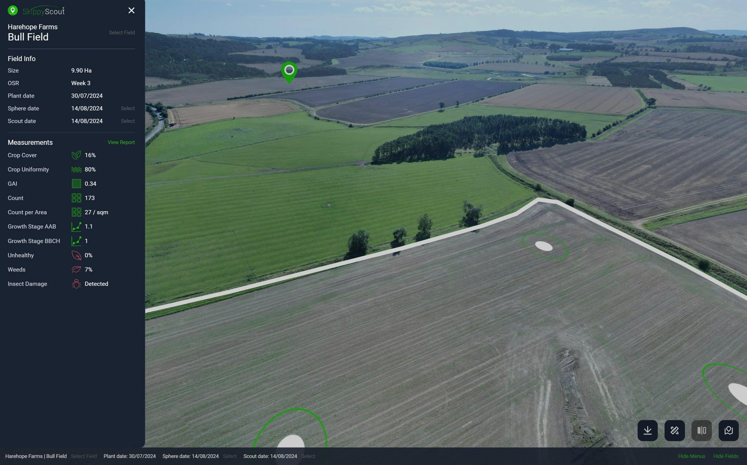
Spheres Version 2 enhances navigation and improves clarity, allowing users to assess their
crops and identify key areas of interest with greater ease and precision. The updated layout
not only simplifies use but also strengthens decision-making by providing clearer insights at a
glance.
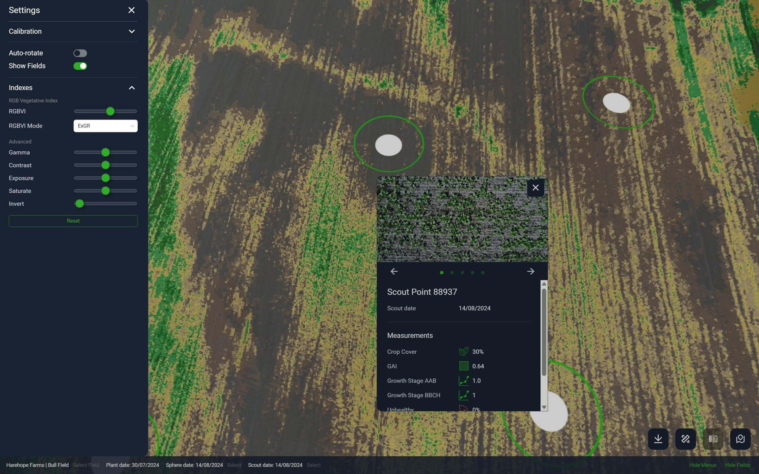
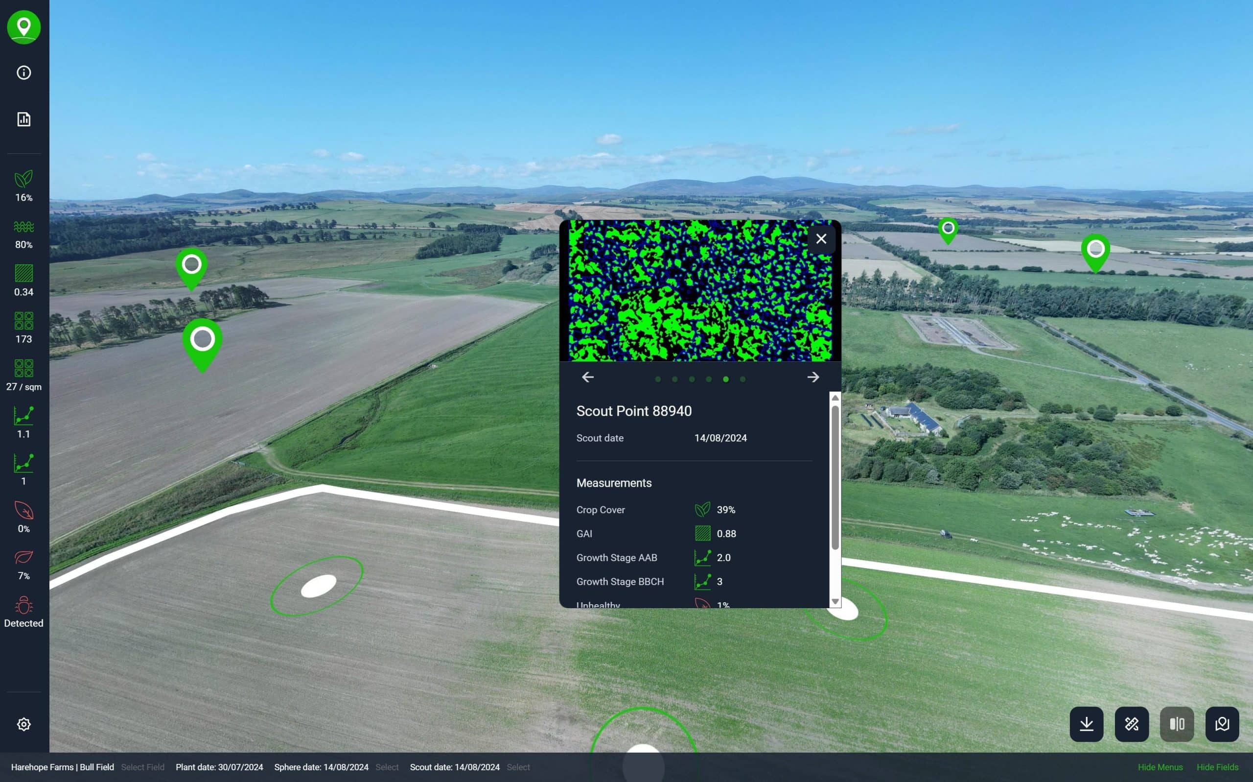
The new version includes a fresh design that is fully mobile friendly, along with new
functionality such as a settings menu, autorotate, and the ability to show or hide layers. Users
can now calibrate more accurately, zoom into images, view scout point AI images, and access
all-new indexing tools for deeper analysis.
“I for one am most excited about the potential of Skippy’s new Spheres Indexing tool, which
will bridge the gap between the prescription mapping tools that farmers are used to in
satellite-powered farm management software, and the on-demand drone imagery that Skippy
Scout provides. Farmers and agronomists will now be able to use this tool to quickly pick out
differences in vegetation density and type, in combination to scout point imagery as a ground
truth, with a view to exporting zoned prescription files for application of inputs.” Says Alex
Macdonald-Smith, C.O.O. at Drone Ag.
Indexing allows crop health indices to be applied directly in real time within the interface,
combined with close-up scouting and AI based analytics, this helps farmers gain a deeper
understanding of their crops by showing which areas are healthy and which may need
attention, allowing them to respond quickly and plan with greater confidence. Its easy-to-use
design and practical tools make field assessments faster and more precise, and this update
further improves the overall experience.
Alex continues, “We’ve improved so many aspects of the interface with this new update, such
as the new mobile version of the interface, and more useful features will be following shortly,
such as comparing imagery across time, area measurements and more.”
Spheres is not only a valuable tool for farmers but is also proving useful in other fields. It has
been used to map festival sites, helping organisers identify suitable camping areas, and has
supported environmental projects such as the river restoration work on the Harehope Estate.
Its versatility makes it an effective solution for anyone needing clear and accurate land
visualisation.
Further updates are already in development, with upcoming features including a field and date
selection list, comparison tools, crop zoning, additional layers of interest such as
infrastructure and OS map features, one-click calibration, annotations, and area measurement.
Users will also soon be able to share links and embed iframes, and benefit from direct export
options minutes after flight.
This release represents Drone Ag’s continued commitment to innovation, ensuring that users
have access to tools that make field analysis more efficient and accurate than ever before. Finally, in an exciting development, drone operators, manufacturers, and software providers
will be able to make direct use of Drone Ag’s Scout Sphere technology. Via web portal or API,
they will be able to upload panoramic imagery captured by any drone platform and receive a
fully featured and shareable Scout Sphere within minutes.
Spheres Version 2 is available now, bringing a redesigned interface and improved
functionality to enhance your experience in Skippy.
-


- *I have permission from the copyright holder to publish this content and images.
Related Posts

Campaign to find world’s longest running agricultural experiments

Call for start-ups as Tesco Agri T-Jam competition returns

Open innovation in a time of COVID-19

The Inevitability of AI Quality Control

“Diamonds in a Paper Crown” at the OFC 2026