Agrimetrics Field Boundaries can change the future of UK farming
The lack of accurate field boundaries has been a pain point for the farming sector since the Rural Payments Agency stopped making these publicly available. To solve this, Agrimetrics has used an AI algorithm to identify the UK’s field boundaries from satellite imagery supplied by Airbus. These boundaries have then been connected to more than a billion other data points – creating an unrivalled resource for stakeholders across the agri-food sector.
Agrimetrics, one of four agri-tech centres at the heart of the UK Government’s Agricultural Technologies strategy, have used artificial intelligence and satellite imagery 13-times the resolution of the industry standard to identify 2.8 million field boundaries across England, Wales, Scotland and Northern Ireland.
Professor Richard Tiffin, Agrimetrics Chief Scientific Officer, explains the reason for their work: “In addition to vast archives of historical information, our sector is capturing huge volumes of new data every day. Unfortunately, this data is rarely filtered by field level. As a result, drawing insights or creating products which can improve land management is often not possible – despite the required data being available.”
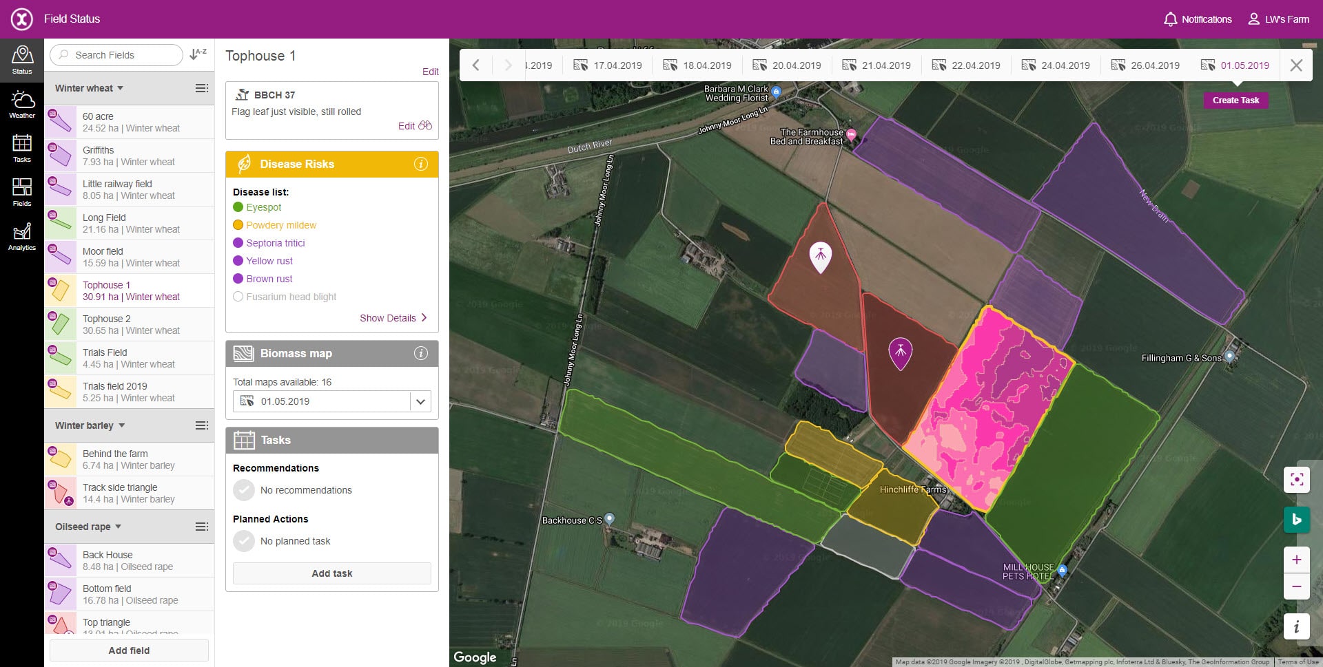
 Now data sets, which could previously only be viewed by region or county, can be viewed from the perspective of an individual field. This has profound implications for a range of stakeholders, producing practical insights which can improve farm management.
Kathryn Berger leads the data science team responsible for bringing Field Boundaries to life, she explains the level of precision it offers: “To create field boundaries, we trained a machine-learning algorithm to look at satellite data, identify the land features which distinguish fields and use these features to highlight the field boundaries.
“Where Agrimetrics differs from other providers, however, is in the precision of the satellite data we use. Whereas industry-standard satellite imagery might have a spatial resolution of 10 to 20 metres, we used premium SPOT satellite imagery supplied by Airbus, which has a resolution of just 1.5 metres.”
Accessing Field Boundaries through Agrimetrics brings several additional benefits, as Tiffin further explains: “Field Boundaries provide a detailed digital map of the UK’s farmed landscape, what’s less well known is that … we have linked our 2.8 million field boundaries to over a billion additional data points, including weather, previous cropping and soil composition. This expands the applications of field boundaries and provides significant time- and cost-saving for our users.
“When the required information is not available through Agrimetrics, Field Boundaries provide the building blocks for assembling and analysing third party data. Processing satellite data is one example. Field Boundaries act as cookie cutters to slice up satellite imagery in order to provide summary statistics for all of the individual fields in the UK.
“This will enable the development of products which could measure in-season crop health and productivity – without ever having to visit a field.”
Read the full story on Agrimetrics’ website: Seven reasons why field data will change British farming
Post Overview
Related Posts
xarvio to showcase Field Manager for first time at REAP
Consus Fresh Launch Innovative AI-based Label Verification Solution
#ATW21 Monday: Precision Nutrition

How open collaboration in agri-tech could help solve the farm profitability puzzle
Consus developers of intelligent audit systems to merge with Affinitus Group