How national data sharing could boost farm incomes and ensure food security
The value of your data is currently at the forefront of many farming conversations, with debates about whether to share it or retain the information for your own farm.
As AI becomes more prevalent and financial challenges mount, it’s understandable that farmers might want to keep their data private to boost their competitive edge. Yet, researchers at Cranfield University suggest that sharing this data could generate additional revenue and ultimately, enhance food security and achieve sustainability goals.
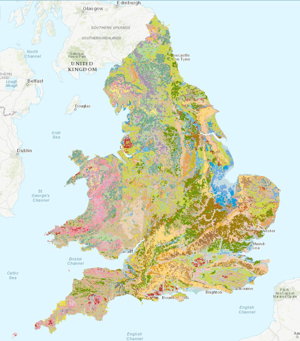
To support this, Cranfield University and Defra have agreed to develop an open access portal of soil and related environmental data for England and Wales, including the National Soil Map of England and Wales (NATMAP).
“We believe opening access to this data is a way to better manage and safeguard our soils and our environment,” says Ron Corstanje, Professor of Environmental Data Science and Head of the Cranfield Environment Centre.
Rob Simmons, Professor in Sustainable Soil Management at Cranfield University, has spent almost two decades focusing on developing applied solutions to on-farm challenges, spanning soil compaction, runoff, erosion control.
A primary focus over the last five years has been optimising the practical use of polymers to improve emergence, establishment, and yield in field grown herbs, salad onions, bulb onions, lettuce and spinach, with his research always in close collaboration with growers so that outcomes are solution based, practical and adoptable.
Working alongside Severn Trent, Southern Water, and Anglian Water, one of his current PhD students Lisa Donovan is modelling the benefits of overwintered cover crops in rotation and their impact on reducing erosion and improving water quality.
“The water companies see agricultural land as part of their critical infrastructure. So, it’s not just the pipework, treatment works, drinking water works, and surface water abstraction; it’s also the fields and the catchments around them,” says Rob.
“They actively support farmers to plant cover crops and implement interventions more than the government does, because they recognise that cover crops play an important role.”
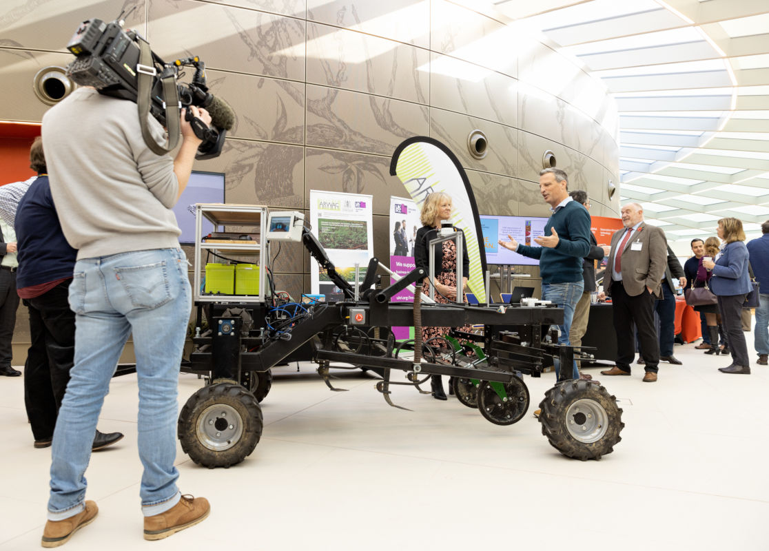
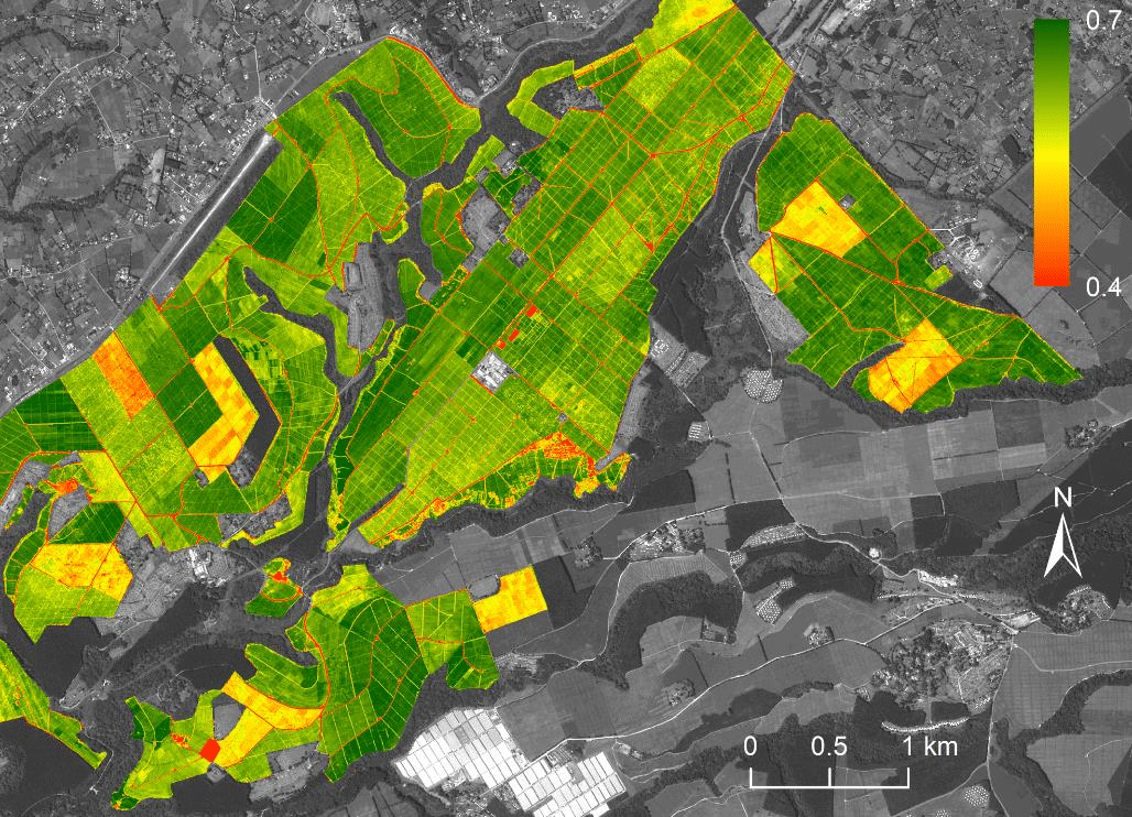
Working alongside Rob Simmons, Toby Waine, academic lead of the Applied Remote Sensing Group at Cranfield University, has been involved in a number of projects to question how we use remote sensing and data to monitor a more complex and diverse landscape.
“Remote sensing techniques we use to look at large areas to access regional production can be focused down to different scales with new high-resolution satellites or drones. So, we can assess what’s in what field, right through to what’s happening within a field, a specific plant, or even an individual leaf, so it’s truly precision agriculture. This becomes more important as we introduce mixed cropping systems, that promote biodiversity to improve sustainability.”
Now, with the uptake of remote sensing and soil sampling tools and data-led decision-making, there is an opportunity to share findings that could benefit all, Rob states.
How sharing data could lead to financial benefits for farmers
Usually, data collected on a specific farm is used solely to inform that farm’s decisions, based on soil type, area, and crop selection.
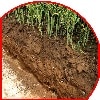
“Farm businesses conduct soil sampling every single year, covering >100,000 hectares of land annually. This is supported by companies such as Agrii, Hutchinsons (Omnia Terramap), and Frontier (MyFarm). Soil sampling and analysis are often repeated on 4-5-year cycles. That data is utilised by the companies and farms that use it for their own decision-making. However, it could be used for national-scale decision-making”.

“All this data could be compiled and, with modern machine learning and AI approaches, mapping approaches, et cetera, if it were combined and made available to farmers, we would have soil maps on a field-by-field basis and even within-field variability.
I’ve seen these maps generated by Omnia Terramap and Frontier MyFarm, and it’s absolutely remarkable.”
Understandably, releasing data might seem like losing a competitive edge; however, Rob sees broader benefits, including potential financial incentives for farmers through sharing data.
“Essentially, if combined with input and yield data, we would have a ‘National Scale Rotational Field Trial’. This would be invaluable for developing climate-change resilience and assessing the effectiveness of soil-health management options. We would also have a continuously updating ‘live’ national soils database.
“It could be used, for example, to evaluate the efficacy of soil management options under SFI or by water companies, looking at reducing phosphorus in rivers, because they would know which fields within their catchments were associated with high levels of phosphorus and hence target management options more cost-effectively.
“There’s so much competition among growers because what they do gives them an advantage over others. However, if data were shared on cross-cutting themes important to everybody, everyone would benefit,” he adds.
Data sharing on a national scale
Looking ahead, Toby is part of the Cranfield University Team launching the new open access soil platform to enable data sharing and research collaboration within the farming community.
Using what was previously the National Soil Resources Institute’s soil information for England and Wales, the team at Cranfield University is making the data available to farmers and land managers free of charge.
“On larger farms, which may use contractors or people who have never been in that farm’s fields, data sharing and technology could provide instant insights into the quality of the land, which crops grow best, and its yield,” says Toby.
“With enough data sets and knowledge and historic patterns, you could start to model what you think would be the best strategy for that field, even if you hadn’t ever been in there,” he adds.
Drawing on his past experiences, Rob Simmons highlights the potential for open data sharing and its role in supporting sustainable food security.
“I worked overseas for 10 years, all over South Asia and Southeast Asia. They used to have what they called lighthouse farms, where you’d have a farm showcasing best practices. That information would be shared, and all the funding would focus on sharing best practices. AHDB runs the Monitor Farm Initiative to highlight best practice in arable farming systems.
The LandIS soil data platform will be available spring 2026, where anyone can access free of charge.
Post Overview
Related Posts
Boosting Efficiency by 40% with Centralised Farm Data Management Software
EU has 100 years of top soil left Soil SIG told
Smart irrigation becoming more attractive option for spuds
Camilla Hayselden-Ashby, fieldmargin, on the challenges of time…
Increasing profit margins with precision livestock